
From the history to the activities, Puerto Rico has everything


Geography
Puerto Rico is a small island located East of the Dominican Republic and Haiti in the Caribbean Sea. Puerto Rico has a tropical climate and many beaches. There is one big rainforest called El Yunque, located on the Island's East side. The island has coastal flatlands, meaning it has numerous beaches and many extended flat mountain areas. The territory has small rivers, dams, and streams due to Puerto Rico having a very tropical climate. Puerto Rico owns 8,870 sq km of land, which makes it bigger than Delaware and Rhode Island combined. Delaware and Rhode Island have around 3,534 sq km. There are many tall mountains in Puerto Rico; the highest peak is 1338 m. These maintained areas are called Cordillera Central. The Island is surrounded by beaches; it has between 300-1200. Puerto Rico also has small islands located off of the coast of the main island called Culebra, Mona, Vieques, and Desecheo. These are all a part of Puerto Rico. Puerto Rico has a primarily tropical climate with many mountains and tropical rain forests, and several surrounding smaller islands that make up the territory.
Google map of Puerto Rico
Elevation Map
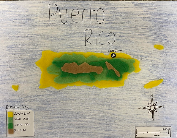
3D map of Puerto Rico that shows the elevation